 weather.cod.edu/help/mchelp.html
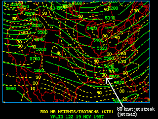
Isotachs are lines that connect points of equal wind speeds on a surface. The closeness of the lines of the isotachs correlates to how intense the wind speeds are. this is a map of the United States that shows heights and isotachs.

No comments:
Post a Comment