
www.xfy.com/.../
A boxplot, or box and whisker diagram provides a simple graphical summary of a set of data. This box plot is showing scores in different subjects including sociology, physics, geography, and math.
 escience.anu.edu.au/.../
 http://www.dplot.com/triangle_plot.htm
 mensch.org/
 www.uwsp.edu/.../09_
 www.coventry.gov.uk/
 www.netmba.com/
 www.frdp-maldives.gov.mv/
 www.globalhumanitarianassistance.org/
 gis.esri.com/.../proc97/to200/pap175/p175.htm
 www.adherents.com/rel_USA.html
 www.lib.utexas.edu/maps/united_states.html
 www.cdc.gov/pcd/issues/2007/oct/07_0091.htm
 http://www.mapresso.com/examples.html
 www.es.mq.edu.au/courses/
 http://www.iupui.edu/~geotech/g337/g337_old/exer7/exer7.html
 http://seamless.usgs.gov/website/seamless/products/1doqq.asp

 www.goldensoftware.com/.../Issue50Sgps.shtml
 www.volcano.si.edu/world/volcano.cfm?vnum=080...
 oldpage.tfri.gov.tw/
 weather.cod.edu/help/mchelp.html
 www.newmediastudio.org/.../Closed_Isobars.html
 www.csc.noaa.gov/products/
 www.amenfoto.com/.../
 http://www.aerialarchives.com/Infrared-Aerial-Photography.htm
 http://www.google.com/educators/kml_contest.html
 personalpages.manchester.ac.uk/.../
 graphics.stanford.edu/papers/flow_map_layout/
 www.esri.com/news/arcwatch/0207/feature.html
 www.neiu.edu/~ejhowens/377/examples.htm
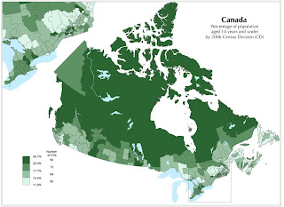 www.statcan.ca/.../figures/figure3.1-en.htm
 www.brocross.com/
 www.psywarrior.com/


http://freepages.history.rootsweb.ancestry.com/~exy1/gracemere/images/Gracemere_cadastral.jpg
This map was taken from an ancestry website. Although the detail is not given, is presents itself as a cadastral map of a families land breakdown in a certain area. A Cadastral map is a map that that basically shows boundries and ownership of land parcels.

http://www.lib.wsc.ma.edu/themap.jpg
This is a thematic map of the median age of population from state to state in the Northeastern and Midwestern United States. Thematic maps are used for focusing in one one or a few particular geographic distributions. For example, on a normal reference map there may be 10 different breakdowns, while a thematic map may take 1 or 2 of those things and give more detail about them on a map.


 This is a mental map taken from 215 residents of 6 different ethnic neighborhoods from the Los Angeles area of different sections of LA. The green sections are basically areas that are less dangerous, or safer to be in. The red areas are less safe in the minds of the people who made the maps and live in the city.